
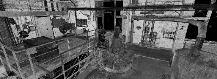

Laser scanning for planning support and documentation.
IKN has its own scanner and processing software.
For the following applications (examples):
- Capture and documentation of existing plants, buildings, terrain structures, etc
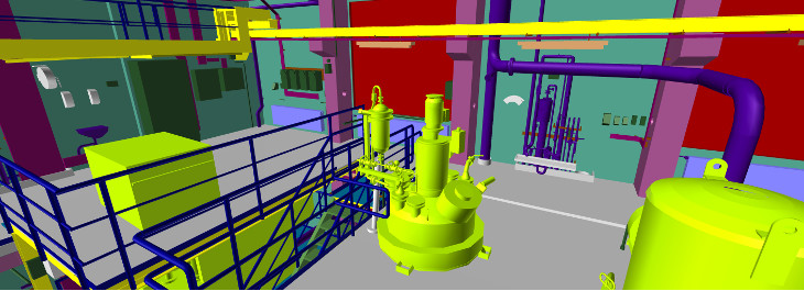
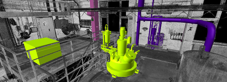
- 3D plant modification / expansion planning using the point clouds.
- Derivation of 3D models in different levels of detail. .
- Creating equipment arrangement drawings based on the point cloud.
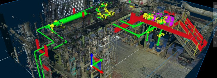
- "As built" comparison of the planning versus construction / assembly.
- Documentation of your technical building services.
Benefits of using point clouds:
- All surfaces in the exposure area are captured.
- It is no longer necessary to do a single point measurement or measurement.of forgotten points.
- A higher accuracy compared to previous measurement methods is achieved.
- The scan data can be used immediately, even without special software.
- Photo-realistic views, also colored on request, make working easier.
- Because of the short stay, disruptions in operation are minimized.
- Transfer or use of the scan data by common software applications (ACAD, Mstation, S3D, E3D etc.) is ensured.
Laser scanning: That's how to plan today!